


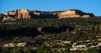


McInnis Canyons in the shadow of Colorado National Monument
MESA COUNTY • What’s great about McInnis Canyons National Conservation Area is how it tests you, says manager Collin Ewing.
No attendants here to tell you where to go, unlike at the nearby Colorado National Monument. No visitor centers. No big parking lots. No pavement anywhere, for that matter. No signs along the teeth-rattling road to warn you of parts that might be impassable.
“If you want ample parking and signs telling you where to take pictures or something, go to a different unit,” says Joe Neuhof of the Colorado Canyons Association. “McInnis Canyons is a more wild, rugged experience.”
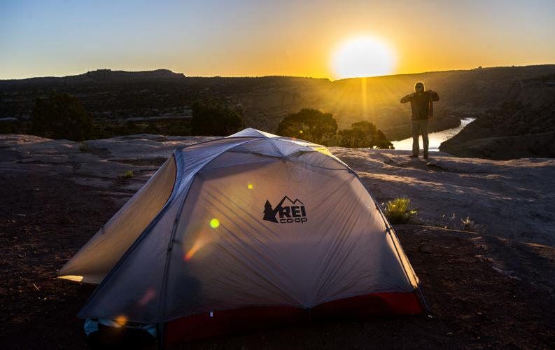
Looking to camp? Keep driving — if you can.
“You’ve got to discover it for yourself, and it’s not easy,” Ewing says. “You have to commit and work hard to make it worth it.”
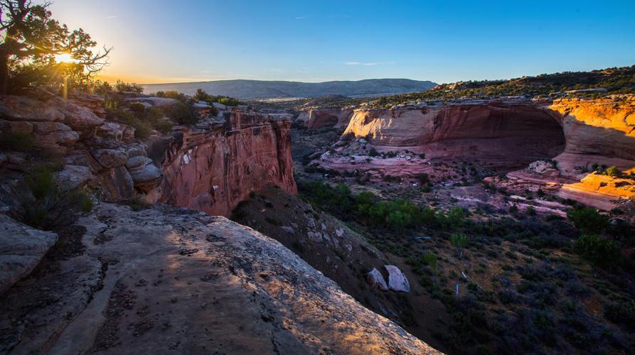
But not on this day. We veer off the highway west of Fruita and spot not a soul for 4 miles, adding to the astonishment that the landscape alone inspires. From the sage floor rise orange rock monoliths, one in the shape of a crown, another like a Hershey Kiss, and another a great slab with a great swell, as if the indent of God’s thumb. Distant mesas seem to stack on top of each other, scraping the big sky here near the Colorado-Utah line.
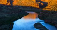
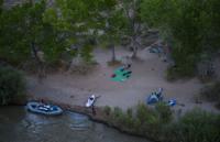
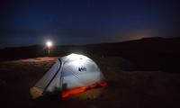
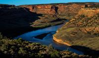
Just 4 rumbling miles, and we can’t imagine a better spot. At the Knowles Overlook, we pitch a tent on a cliff, from where we do spot souls far below: floaters camping beside the Colorado River. The green water runs wide and calm between sandstone walls that turn black in some places — the 1.7 billion-year-old rock layer called Vishnu schist.
From another vantage point we see singletrack between a canyon corridor, flowing through alder trees and finishing at the riverbed. The Colorado Plateau stretches every which way, out to the other treasures it keeps: the Grand Canyon and Arches, Bryce and Zion national parks.
And at all of those at this very moment, it’s hard to imagine the solitude we find at this place with a far less familiar name.
At McInnis Canyons, “timing is everything,” says Ewing. While Colorado’s outdoor lovers flock to the high country in summer, it’s not uncommon to find the desert left almost entirely alone.
Heat is the detractor, of course. But cool mornings here are prime times for locals who have to share with mountain bikers from everywhere throughout spring and fall. Breezy evenings like these, too, are an increasingly rare delight in the state’s busy wilds.
Our timing was good. Securing this spot later in the year? “Good luck,” Ewing says.
He oversees the Bureau of Land Management’s 2004 plan, which keeps McInnis Canyons what it is. In a legislative effort spearheaded by local U.S. Rep. Scott McInnis, the land joined a small family of national conservation areas.
The place was once a lawless, rip-roaring expanse, “a free-for-all,” says lifelong Fruita resident and former mayor Lori Buck. Then a citizens advisory council was formed to influence the BLM’s management of the new national conservation area — a designation that was preferred over national park status.
“Generally speaking, it’s been very well-received,” Buck says. “People appreciate that asset and how it’s being managed for sure.”
People wanted old uses such as ranching and hunting to last. They wanted history to last with the ruggedness, so something like the Old Spanish Trail — known as America’s “longest, crookedest, most arduous mule route” — could exist without interpretive signage.
Included in McInnis Canyons was the Black Ridge Canyons Wilderness. The 75,000-plus acres are home to a large concentration of natural arches, second only to Arches National Park in North America.
Before the national conservation area tag, the arches were considered to be under a Colorado National Monument expansion. Now they are reached by long day-trippers on foot, or by drivers who are allowed through the monument’s gates and pointed to a wicked road not to be underestimated.
“The people at the visitor center tell me the No. 1 question they get is, ‘How do you get to the arches?’” Ewing says. “Then they try to convince them not to go because the road’s so bad they’re probably not prepared for it. But that’s kind of what makes it special.”
McInnis Canyons is one of 16 national conservation areas and one of three in Colorado. It’s more popular than the other two, Dominguez-Escalante and Gunnison Gorge, greatly due to nearby Fruita’s emergence as a world-class mountain bike destination.
Extending to Moab, Utah, the vaunted Kokopelli Trail runs through the area, which also encompasses the prized OHV playground that is Rabbit Valley. Hiking- and horseback-only trails add to the 247-mile network.
And though magazines have hailed McInnis Canyons as a “hidden gem,” it has been widely discovered. The estimated visitation of 300,000 every year approaches the latest count at Colorado National Monument, 375,000.
“We’re not keeping up with demand,” Ewing says, leading to discussions of more campgrounds and bathrooms. Rabbit Valley in particular, he says, is seeing more dispersed campers who are damaging the land with the sites they choose. A permit system recently was established for overnights along the river.
It’s not the “free-for-all” Buck knew growing up in Fruita. But it’s better for it to be shared and conserved, she says.
“We forgot how great it was for a while. We just didn’t know. We didn’t understand how truly unique it was to be living in a place with so many acres of public land,” she says. “We’re very lucky to have that in our backyard.”


 Your Privacy Choices